DATA FOR DEVELOPMENT
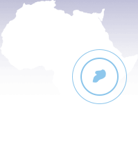
uganda
YEAR STARTED: 2017
PROJECT
Food security and seasonal migration monitoring in Uganda
SUPPORTED SDGs
OBJECTIVE
This project aimed to build a solution to proactively identify shortages in food supply by developing a crop yield model for two major food crops: maize and sorghum.
PROBLEM STATEMENT
According to the Food and Agriculture Organization (FAO), more than 85% of Uganda’s total population live in rural areas and depend mainly on agriculture for their livelihood. Moreover, the World Food Program (WFP) estimates that about 20% of people in Uganda live below the poverty line, while half of all Ugandans consume fewer calories than they need every day.
With a fast-growing population of 39 million in 2018 that is expected to reach 100 million by 2050 (WFP – 2018), Uganda needs to maintain a strong agricultural sector to reach the first two SDGs of No Poverty and Zero Hunger. Providing objective, precise, and scalable insights about the production of important crops in the most food insecure part of the country is critical to designing crisis response and interventions to achieve the SDGs.
However, Uganda lacked an approach and tools, such as a crop yield model and identifying internal seasonal migration flows in and out of an area, to proactively identify shortages in food. This information could give an estimate of food required and a comparison with available food resources to key stakeholders for timely actions.
APPROACH
- DIAL and its partners sought to leverage mobile phone data collected from MNOs, satellite data, and ground truth data to understand seasonal migration flows of people and crop estimates. Crop estimates were done for maize and sorghum, which account for 98% of total farmland, and hence comprise a major portion of food for people in the Karamoja region.
- The crop yield model used openly available multispectral satellite images with good temporal and spatial resolution, and it provided a suitable alternative for crop condition and yield estimation for maize and sorghum. The model thus provided reliable forecasting of the future food security situation of maize and sorghum.
- Mobile network operator data was used for dynamic population mapping and to understand the seasonal migration flows of people in and out of the Karamoja region.
- To validate and train the crop yield model, ground truth data from two different field campaigns done in Karamoja was used. One was carried out in July 2017 by the World Food Program (WFP) Rome. One was performed by this initiative in September 2017.
- The purpose of these field campaigns was to obtain three main types of measurement:
- Position of plots and identification of the land use to train and validate the crop type map
- Harvest index measures to directly feed the light use efficiency model
- Yield measures to validate the final output of the model
SUMMARY OF FINDINGS FROM RESEARCH
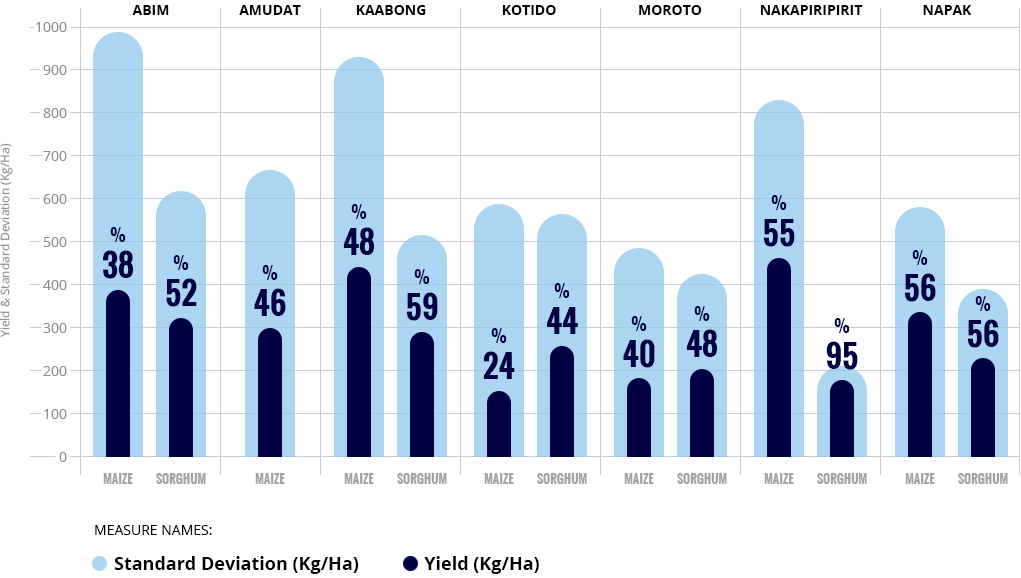
There was a large variance in the yield measures among the different fields. This means that the yield products among the different fields vary significantly, which can be a sign of a problem for fields with very low production levels. This finding was confirmed by food security and water management specialists at FAO Uganda. Knowing in which district the variance is the highest and lowest will allow food security actors to prioritize areas of intervention.
Average Yield Measures and Standard Deviation per District:
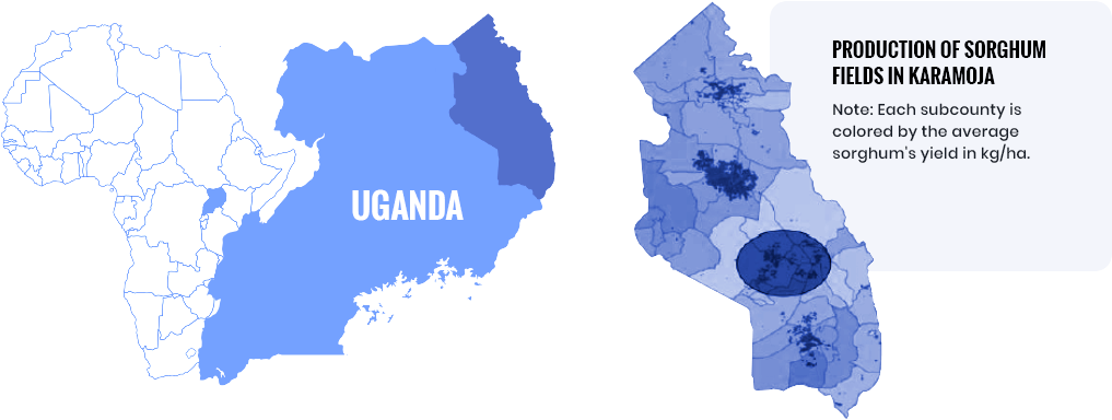
More than 95% of the sorghum fields in Karamoja are clustered in only four specific areas, while maize is grown more sparsely over the region.
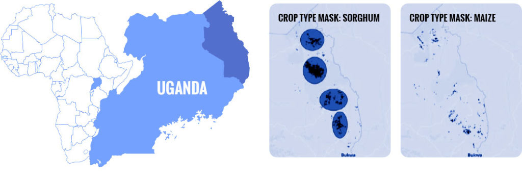
A severe drought or other extreme conditions in certain parts of Karamoja can significantly impact the total production of sorghum for the season, due to the close proximity of the fields. Yet, the maize fields in Karamoja are much more widely spread out, which suggests that extreme conditions in one area should have a less devastating effect on the total production of maize.
One of the four clusters (~25% of potential production) of sorghum fields is located at the center of the least productive region of Karamoja.
Seasonality of mobility patterns in Uganda is more pronounced in Karamoja, where short-term migration is highly dependent on local conditions, such as access to water, crop yield, and quality of cattle’s pasture.
RESULTS
Insights from the dashboard have helped food security experts in Uganda identify bottlenecks in the production of crops, which allowed for better prioritization of interventions.
There has been interest from other countries like Burkina Faso to replicate the platform to estimate crop yield for other crops.
OTHER CONSIDERATIONS
The project relied on open source satellite data as well as open source software to process satellite and telecom data. This provides ample opportunity to replicate and scale the solution to other geographies, regions, and sectors.
PARTNERS
DIAL convened a diverse range of stakeholders, including donors, multilaterals, NGOs, and the government, to undertake the Uganda data demonstration model.


